Where chunky_milk has been


Click it! It's an interactive map. Articles are linked by location.
Showing posts with label mountaineering. Show all posts

Sunday, January 11, 2009

Ice Climbing at Ouray, Colorado


I recently spent a week ice climbing in the little mountain town of Ouray, Colorado. It's nearest big-name neighbors are Telluride and Silverton. I skied at both neighboring towns. Ouray is the national hotspot for the niche sport in the outdoor community: ice climbing. What is ice climbing? Picture a giant waterfall frozen solid, now put two sharp axes in your hands, and strap 24 steel spikes to your feet, start climbing. It's fun! Ice climbing is a unique form of climbing requiring a different set of skills than other disciplines of climbing or mountaineering. Ice climbing is delicate; requiring precise pick placements, yet enough strength to penetrate the ice. It's spooky to climb a medium that is constantly growing, cracking, melting, and falling down on top of you. A helmet is required equipment. It's not just for safety, it keeps the ice chunks you inevitably let fly from nailing you in the head. Unfortunately helmets (save a few ice specific ones) don't protect your face, leading to more than a few bloody faces, including mine and my partners.
We climbed primarily at the Ouray Ice Park, as the snowpack in the backcountry was avalanche prone due to the recent, heavy snowfall. The Ouray Ice Park is a public climbing area owned by the city of Ouray that allows free access to an entire canyon full of steep fresh ice. The main city water line runs along the top rim of the canyon, and strategically placed water nozzles spray the cliffside at night. After a few months of freezing temperatures and running water, the Ouray Ice Park comes to life. The rumoured beginning of the Ouray Ice Park is that a local with powerdrill drilled a hole in the main city water line, and let it run until an ice climb was formed. Ouray, Silverton, and Telluride are home to countless quality backcountry ice climbs as well. Unfortunately we didn't get on many of them because of the deep snow, but deep snow usually means good skiing instead.
Nice View in Ouray


Looking into the canyon from the upper bridge


Ice tools, carabiners, and an ice screw for anchoring


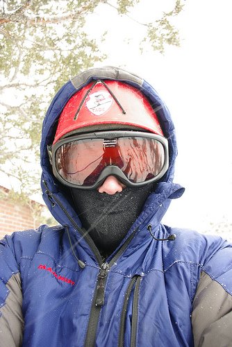
Of course, it's cold! I swear I'm smiling under all that

Saturday, January 10, 2009

Thursday, January 8, 2009

San Juan Photos

Half the photos are up. I'm sleepy, so the rest will be posted later.


Saturday, January 3, 2009

Fun in the San Juan's

It's cold here!

Also, the internet sucks here, so only a few photos got uploaded. I spent a few days climbing in the Ouray Ice Park. The ice is thin this year due to the heavy snowfall, which inhibits good ice devolopment. At the ice park, a group of Texas Cavers saw my bumper sticker and invited me to ski with them at Silverton Mountain. Silverton is a step up from anywhere I've ever skied; It only serves double black runs. Tommorrow will be more skiing at Teluride, and the following days will be backountry ice climbing in the Ouray area.

Photos:
http://www.flickr.com/photos/33754295@N03/3164473811/

Sunday, December 28, 2008

Mt. Rainier

My dad, friend Kyle, and his dad John hiked and climbed Mt. Rainier. We did over 50mi. of the Wonderland trail around Mt. Rainier. We spent about a week on the trail, mostly in the rain. After a quick break, we headed out to climb the peak. We climbed a variation of the very common Disappointment Cleaver route. Instead of heading up the Muir snowfield, we headed up the Cowlitz and Ingraham glaciers to the bottom of the disappointment Cleaver.
The Willis Wall on Mt. Rainier, taken from the Wonderland Trail
A few years ago, this was a river of glacial ice, now its a field of gravel. Global warming?


One of our campsites, not far from the top


Little Tahoma Peak from our campsite


Crevasses on the Cowlitz glacier

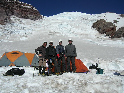
The very windy summit, as wide as a football field

Rocky Mountain National Park

We first climbed Long's Peak. The young guys took the very easy but technical Cable's Route. The old guys took the Keyhole Route, which is a long, steep, loose hike with a little rock scrambling. It's crowded in August!

Staring directly at the Cables Route on Long's Peak, which follows right up the center. Photo taken from our campsite.

Climbing the Cable's Route on Long's Peak

The old guys met us at the top. John leads the crowd up the homestretch of Long's Peak Keyhole Route

We also attempted Mt. Ypsilon. The old guys took the Southern Ridge, and the young guys took the Northern ridge, called Blitzen Ridge. Both teams were turned back by an impending afternoon thunderstorm. Blitzen Ridge is lightning prone because of its prominence, and becasue you can't see the clouds coming your way until you're almost to the top, which is exactly what happened to us. We finished all the technical climbing, and had some scrambling left to finish it out. The old guys made it to about the same altitude. We had to do half a dozen rappels, but the rock was terrible quality, so it was a painstaking process to set anchors. It took few hours to rappel maybe 700'

Our rope was a tangled rats nest

A few pitches high climbing Blitzen Ridge on Mt. Ypsilon


Kyle shows his appreciation for long distance rappelling


Interesting formations at the Garden of the Gods

Saturday, December 27, 2008

Sufferfest 2007: Grand Teton pt.1

Sufferfest 2007 was a 3 part adventure: backpacking the Teton Crest Trail, Climbing the Grand Teton, and seeing Yellowstone. For now I'll just talk about the most exciting part, climbing the Owen-Spalding route on the Grand Teton. The Grand Teton is the highest peak in Grand Teton National Park. The Owen Spalding route is a classic route up the back side of the peak. It is a technical climb, requiring most of a full day of technical climbing and an arduous approach hike. I was accompanied on this climb by my friend Kyle, who is studying Outdoor Recreation at the moment.

Since this peak requires both lots of climbing and lots of hiking, we decided to get a head start on it and camp a few miles closer to the technical climbing section. Next day we woke up at 2AM to get an early start, hoping to beat the summer afternoon thunderstorms. The weather was perfect, and we made it to the top with only minor incident.

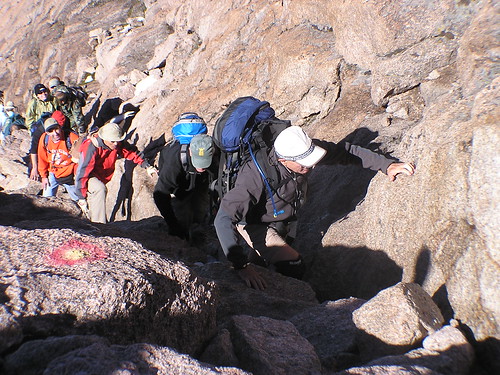
Kyle feels the effects of a 2AM start

We started out at 2Am to get a head start on the weather, to no avail. We hiked quickly through the darkness, and managed to follow a trail that lead to a boulderfield. The trail died in the boulderfield and went nowhere. We retraced our steps via GPS, but the "trail" fooled us into thinking we were on the right path. Instead we waited until well after 4AM until we spotted some headlamps bobbing in the distance. We sprinted through loose rocks after them, and found our way back to the saddle, where the real climbing begins.

Kyle negotiates the easy "Belly Crawl" with an
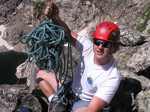
 exhilarating 1000'+ of exposure on his left

Dawn on the Middle Teton, taken from high on the Grand Teton


Proof- A USGS point marker, strangely the altitude is missing?


Our dads hiked in celebratory beers packed in ice for the occasion